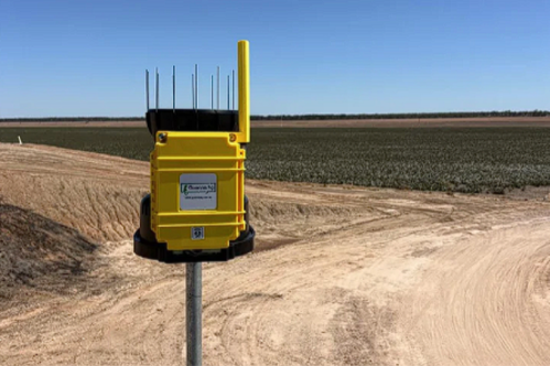
WAND (Weather and Networked Data) is Australia's spray drift hazardous weather warning network, developed with the Grains Research and Development Corporation (GRDC) and the Cotton Research and Development Corporation (CRDC). A network of profiling inversion towers across NSW and QLD grain and cotton regions gives growers and spray operators real-time visibility of hazardous temperature inversions.
Benefits of weather and spray advisory

Improve spray efficiency
It tells growers when they can spray, rather than when they can't. Being able to forecast inversion conditions allows growers and spray applicators to plan when to get their machinery ready to go into a field.

A proactive approach
Spray drift onto crops, doesn’t show symptoms for 7 to 14 days which is too late to do something about. If we can detect a drift event early, then we can start applying management techniques right from the outset to minimise the impact of the drift away.

A free tool for everyone
Free for everyone and create an account. You will be able to start accessing the data straight away and it's in real time which is a huge advantage to you managing your decisions around spraying and workload.

How WAND works
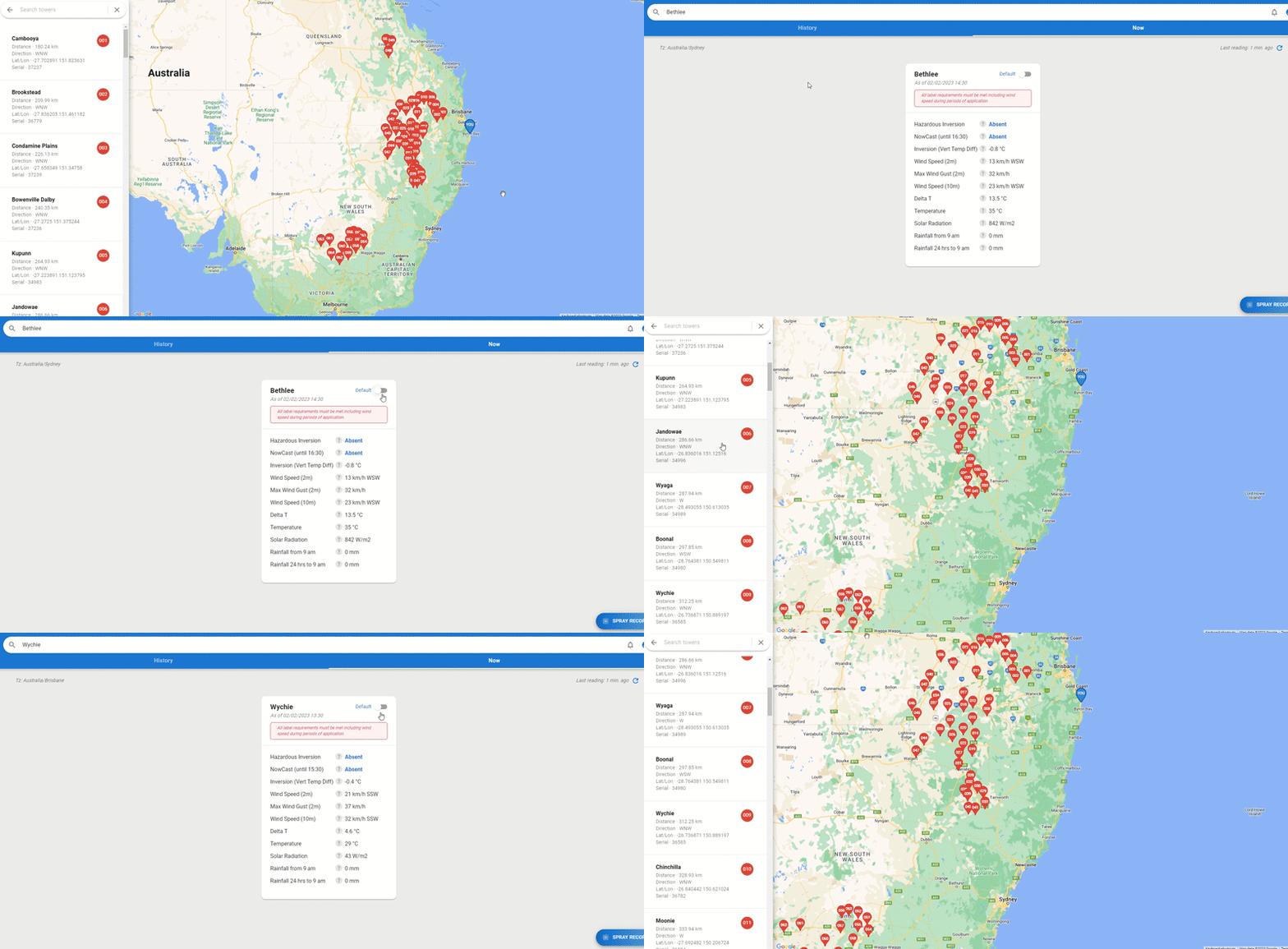
WAND is a world-first network of 102 profiling inversion towers across the grain and cotton regions of New South Wales and Queensland. Each tower uses remote sensing and proprietary software to deliver real-time weather data updated every 10 minutes plus a forecast of inversion risk up to 24 hours ahead.
What is a hazardous temperature inversion? Normally, air temperature drops the higher you go. During an inversion, that pattern flips: a layer of warm air sits above cooler air near the surface, creating a stable "lid" that stops normal air movement.
For spray application, this is a serious risk. Spray particles released during an inversion can stay suspended and concentrated near the surface rather than dispersing, potentially leading to off-target contamination or exposure. Without air mixing, fine droplets can also travel long distances in an undisturbed, low-level air stream — in directions that are hard to predict and depend heavily on the surrounding landscape. That's why monitoring for hazardous inversions is essential to safe, effective spray application.
To learn more about the WAND network, watch the video.
Spray window improvement
Since the launch of WAND, we have accumulated over 120,000 hours of observations* and been able to determine the following:

10.9 hrs
The average hours/day/site where inversion is present

6.5 hrs
The average hours/day/site where hazardous inversion is present

0.5 hrs
The average hours/day/site when a hazardous inversion is present, but a temperature inversion is not

4 hrs
The average adjusted ‘benefit’ the WAND network is providing growers/spray applicators per day
The below graph shows the hazardous inversion graph versus temperature inversion graph for the same location at the same time demonstrating the increased spray window that the technology provides for growers.

*Date range: December 2022 to May 2023
Our technology
WAND technology addresses this issue by providing real-time determinations of local vertical turbulence characteristics and comparing them against predetermined thresholds. This determines whether there is sufficient vertical turbulence for adequate deposition and dispersion of spray droplets in a particular location, regardless of whether temperature inversion conditions are present.
The data is recorded in our inversion towers.
See solution demonstration which highlights the coverage of our network.
Our customers
“One operator could theoretically cover an additional 200 hectares per day”

Complete your weather toolkit
WAND tells you when it's safe to spray. GoWeather and GoRain fill in the rest of the picture, giving you accurate, on-farm weather and rainfall data to support every decision, from spraying and irrigation to harvest timing.
On-farm weather station
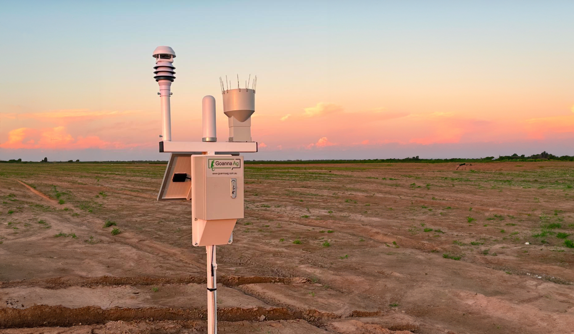
GoWeather is Goanna Ag's most popular device: a reliable, solar-powered automatic weather station built to withstand harsh conditions in the field, with no moving parts to wear down over time.
GoWeather®
GoWeather is built to last in the harsh elements it's there to track. Solar powered and low maintenance, it delivers environmental data that directly impacts your farming decisions, with 10-minute recording intervals, real-time and historic data accessible through our easy-to-use app, and seamless integration into production management and forecasting tools.
-
Accurate measurement: Accurately and reliably measure a range of environmental elements with this one device.
Data dashboard: Access all your data in our easy-to-use App, you can access current and historica data.
Quality device: This device has been built to withstand harsh elements, with no moving parts, this solid weather station is less likely to wear.
Integration capabilities: You can integrate this solution into product management and forecasting tools to provide additional information to enhance your decision making and improve your operations.
Easy install and maintenance: This device is simple to install and even easier to maintain.
Affordable planning: The time saving benefits of this device outweigh the minimal investment.
-
Wind speed
Range: 0 m/s to 40 m/s
Resolution: 0.1 m/s
Accuracy: At 0ºC to 55ºC (no precipitation)
Humidity
Range: 0-100%
Resolution: ±1%
Accuracy: ±5%
Wind direction
Range: 0º to 360º
Resolution: 1°
Accuracy: ±3 °C
Solar radiation
Range: 0-1750W/m2
Resolution: 0.1 W/m2
Accuracy: ±5%
Barometric pressure
Range: 150 hPa to 1100hPA
Resolution: 0.1 hPA
Accuracy: +/-1 hPA
Air temperature
Range: -40ºC to 80ºC
Resolution: 0.1ºC
Accuracy: ±0.3ºC
Remote rainfall monitoring
GoRain is a high-accuracy, low-cost automatic rain gauge that reports rainfall the moment it happens, no more trekking out to check a gauge manually.
GoRain®
Rainfall is one of the most important and most variable inputs on your farm. GoRain delivers accurate, local rainfall data every 10 minutes along with a 10-day forecast, helping you make smarter agronomic decisions, protect yield, and get more value from every drop. Built tough for Australian conditions and simple to use on our app.
-
Accurate, local rainfall data: Know precisely how much rain has fallen on your property not a nearby station.
Confidence in changing conditions: 10-day forecast keeps you ahead of what's coming, season after season.
Better management & timing: Make confident decisions on planting, spraying and irrigation based on real data.
Fewer surprises, better outcomes: Reduce costly mistakes and improve yield by acting on accurate, timely information.
Easy install & maintenance: Simple to install, even simpler to maintain.
-
Accuracy: ±3%
Range: 0-5.67 in/hr
Updates: every 10mins
Power: 12V 25Ah
4G LTE Cat-M1
Solar Charging